
Navigational Warning
Share on
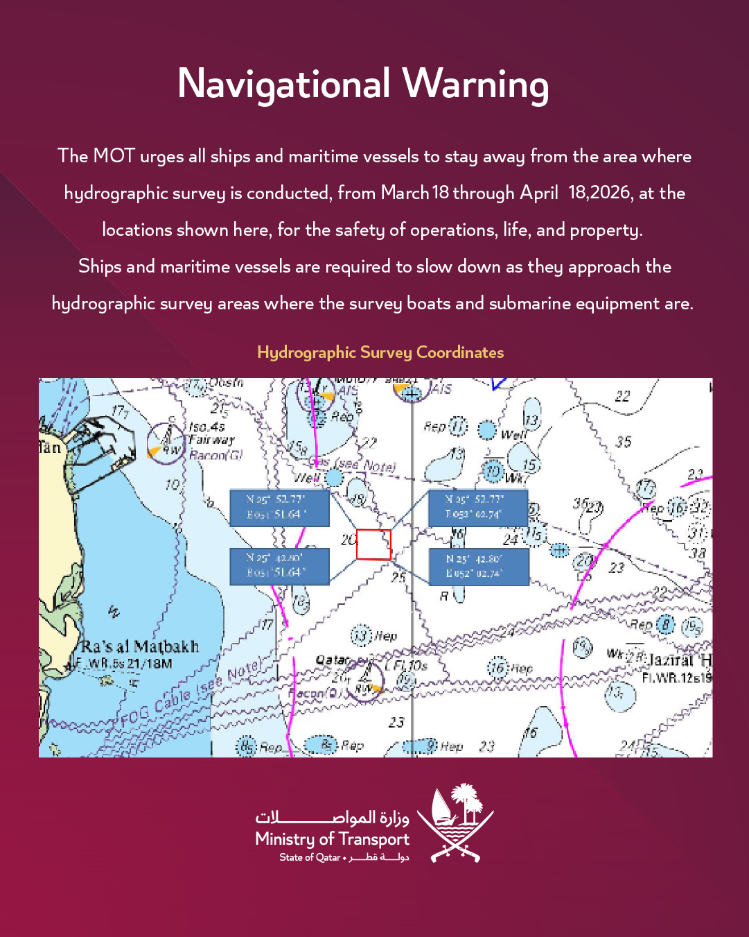
The MOT urges all ships and maritime vessels to stay away from the area where hydrographic survey is conducted, from March 18 through April 18, 2026, at the locations shown here, for the safety of operations, life, and property.
Ships and maritime vessels are required to slow down as they approach the hydrographic survey areas where the survey boats and submarine equipment are.
Hydrographic Survey Coordinates:
📍 N 25° 52.77' — E 051° 51.64'
📍 N 25° 52.77' — E 052° 02.74'
📍 N 25° 42.80' — E 051° 51.64'
📍 N 25° 42.80' — E 052° 02.74'
-
In English
Hydrographic Survey Coordinates.pdf